THE BLUE LINE - Winner of Kiev Islands Master Plan Competition
By Bustler Editors|
Tuesday, Feb 21, 2012

A few days ago, we published BudCud's finalist entry to the Kiev Islands Master Plan Competition. Here is now also the winner of the First Prize, the concept THE BLUE LINE by Romanian team Wolf House Productions and Gabriel Pascariu.
Project Description from the Architects:
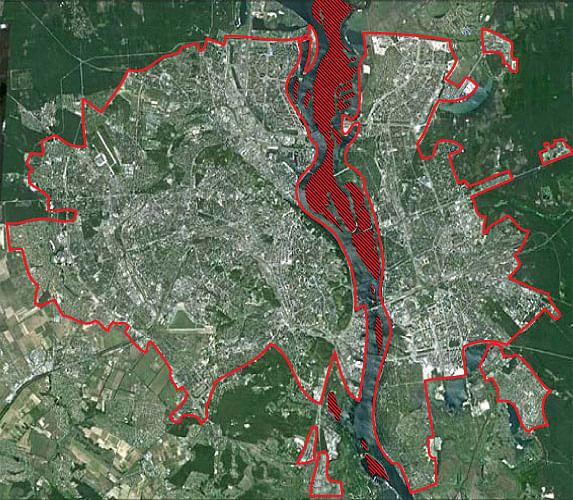
Aimed at preservation and sustainable development of eleven major islands on the Dnieper River and in the center of Kiev city, the competition was promoted by Kiev Municipal Investment Agency, the City of Kiev and Ukrainian Architects Union. It called for the best proposals in promoting natural heritage awareness and providing clear regulation for tourism, sports and recreational activities within the natural environment of the Dnieper Bay. The main objectives of the project are to preserve and develop the Dnieper islands in a sustainable manner and to set Kiev as an attractive European metropolis and touristic destination.
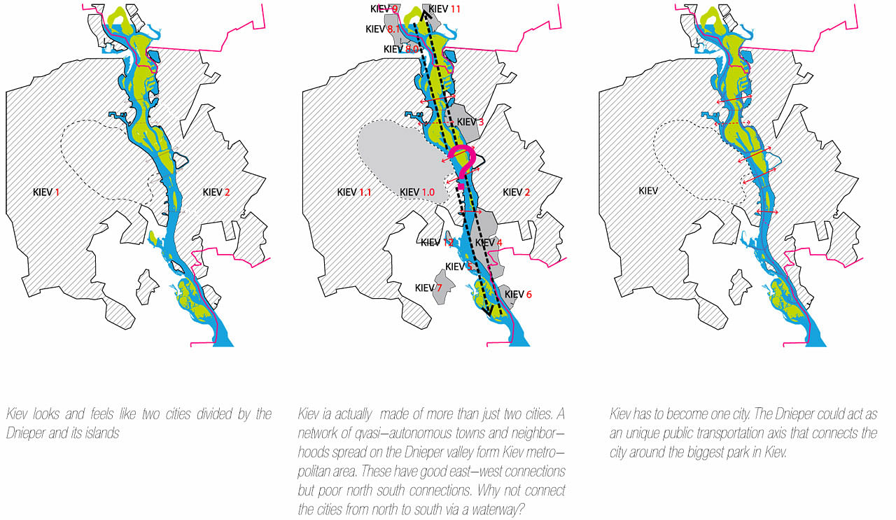
Today, Kiev feels and functions as a divided city by the Dnieper’s Bay running from north to south. In the middle of this growing metropolis, Kiev’s islands with their natural reserves and endangered species, have to bear most of the collateral damage done by urban/infrastructural development. Being the largest economy in Ukraine and given the geographical opportunity to lie between Eastern Europe, Russia and Central Asia, Kiev will soon become a strong regional economic hub. In order to attract foreign and local investments the city needs to market a clear and tangible urban vision.
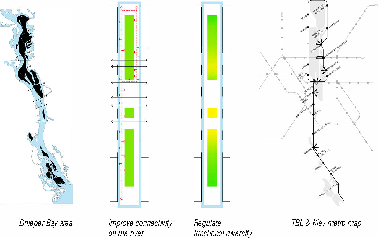
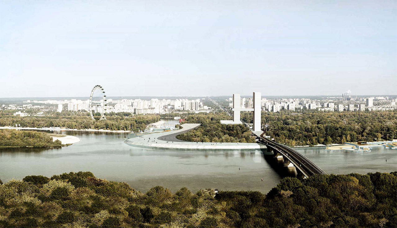
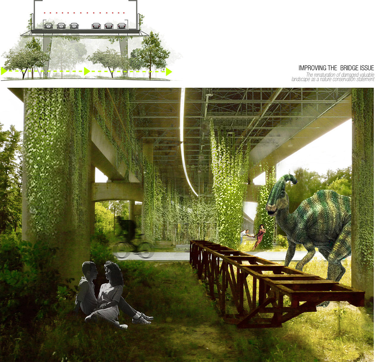
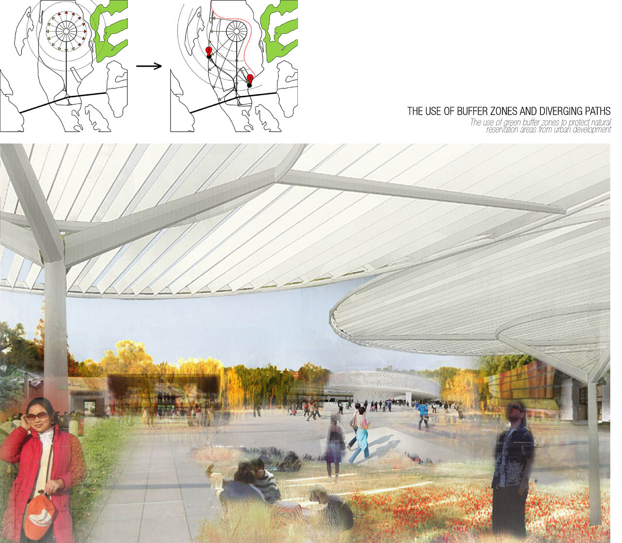
THE BLUE LINE (short, TBL) aims at providing a sustainable development framework for the Kiev islands as well as an infrastructural backbone for the future urban development of the entire metropolis. We suggest a paradigm shift: from large scale urban and infrastructure projects (specific to Ukrainian urban planning) to a more fluid and efficient place-making driven urbanism. Many of the islands’ masterplan features are already in place, the city just needs to discreetly enhance their value and connect them efficiently. Ultimately, TBL will provide solutions for three of Kiev’s main issues: north-south connectivity, need of a coherent urban strategy and sustainable development of the city’s most important natural symbol, the islands complex.
The project is drafted considering five key aspects:
- sustainable infrastructure and improved connectivity of the islands
- tourism and economic development
- natural conservation planning
- governance
- city branding and city promotion
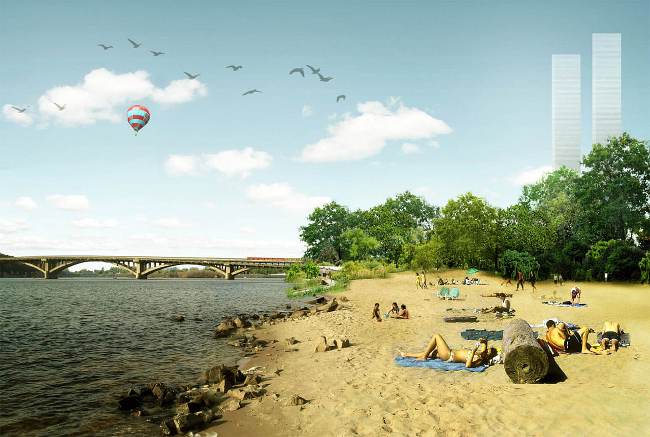
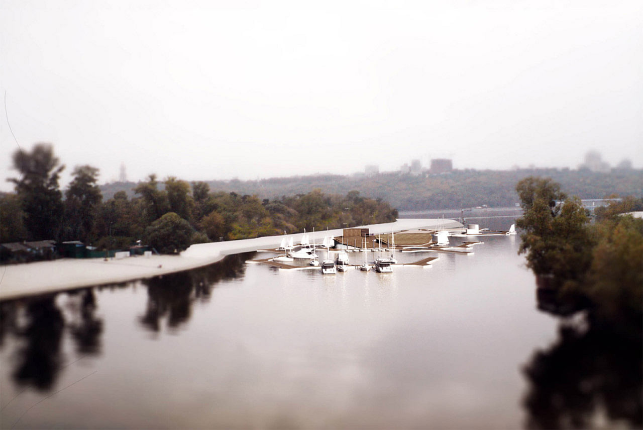
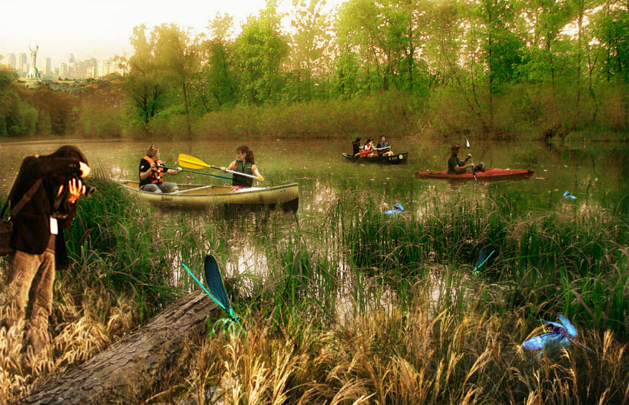
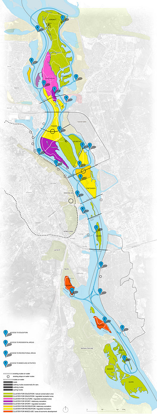
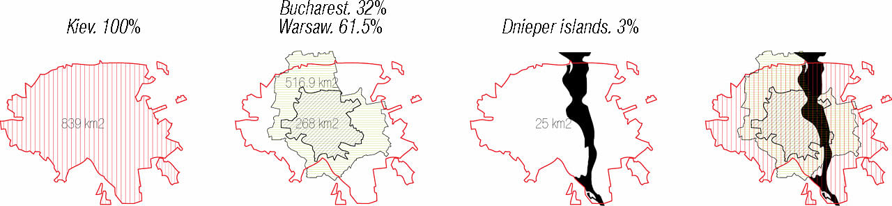
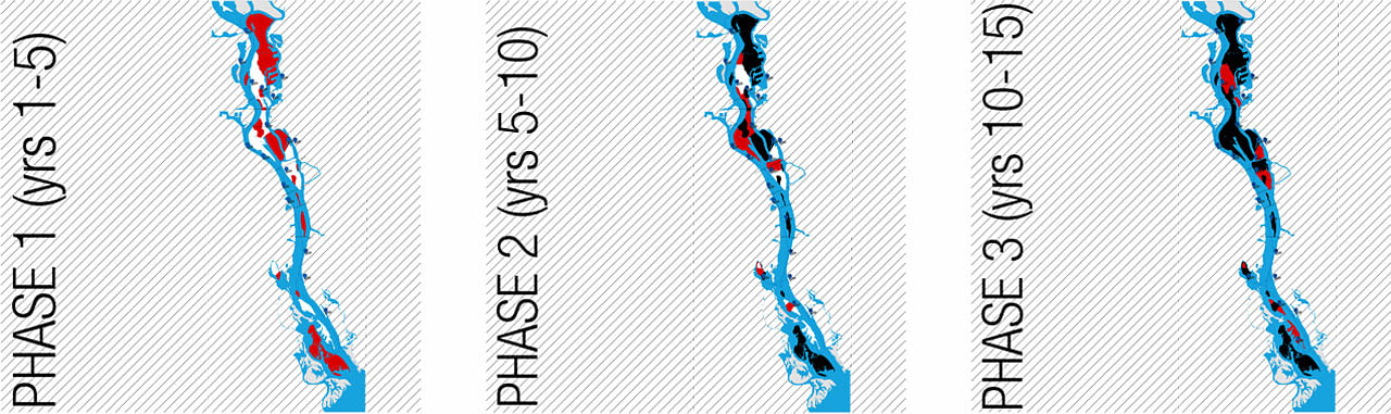
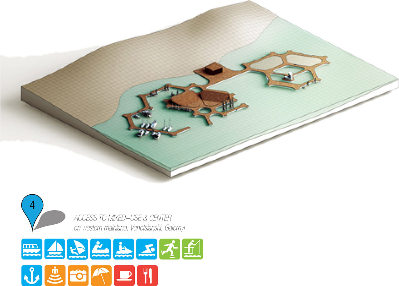
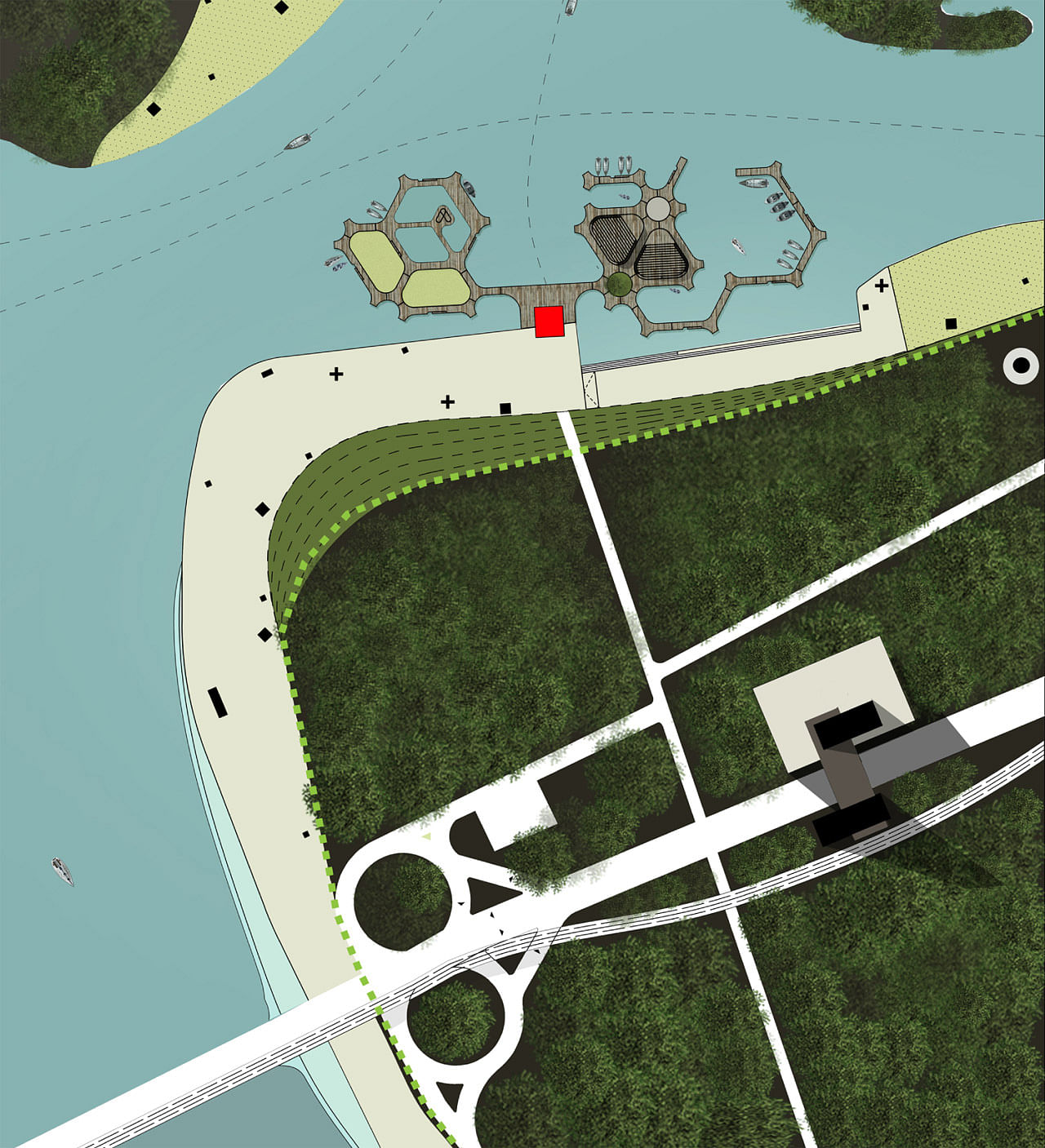
The general development concept of the islands encourages mixed-use and recreational activities in the three islands near city center (Venetsianski-Truhaniv-Dolobetskyi) and is gradually restricting human presence on the northern and southern reservation islands (Muromets-Lapuhovatyi and Kozachyi-Zhukiv-Olzhyn). The north half of Venetsianskyi, southern tips of Truhaniv and Dolobetskyi islands have great potential for becoming an attractive city wide services and entertainment hub set in a natural environment. The north and south edges of the islands complex are important natural conservation areas where the landscape gradually changes from leisure activities into a valuable wildlife reserve. Here, human presence is occasional and discreet. Access on these islands can only be done through TBL stations and regulated by the local administration and the Center of Ecological Monitoring in Kiev. Also, the stations will be used for implementing community educational programs that encourage locals to protect the unique ecosystem. Rather than enforcing fence-like restrictive policies, that ban it in the reserve, we support human presence and think that it is needed here. To inhibit past activities like illegal fishing and garbage disposal, access has to be responsibly regulated by a bio-research center run by the prestigious M. Gryshko National Botanic Garden. The main focus of this center is aimed towards research and education on ecosystem protection and sustainability issues.
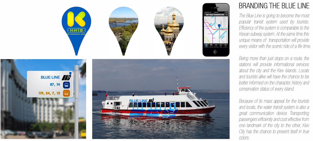
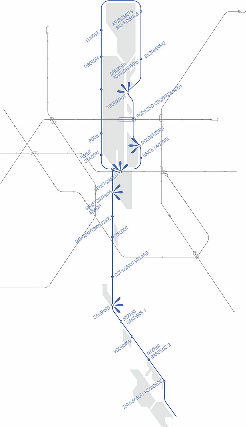
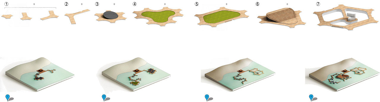
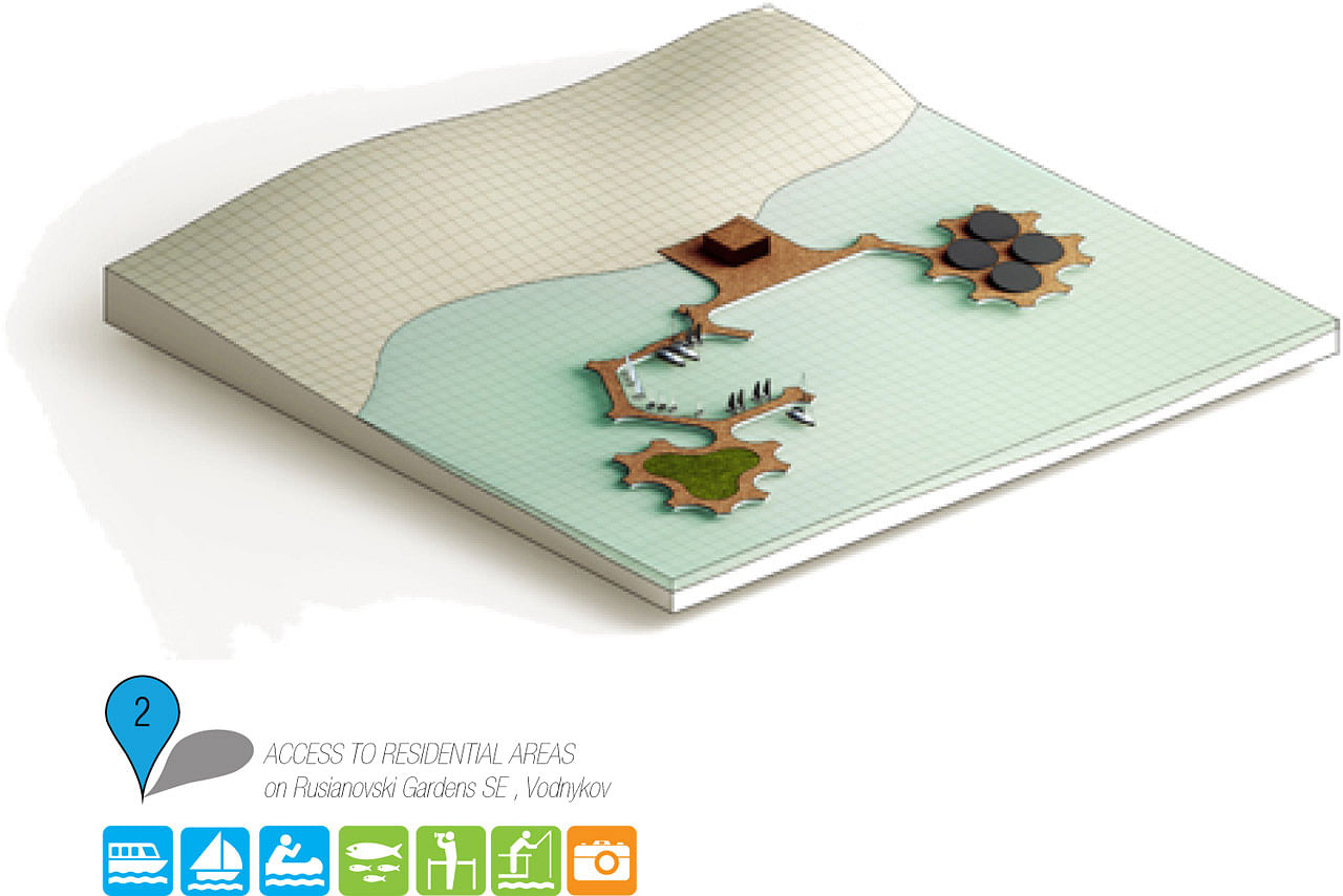
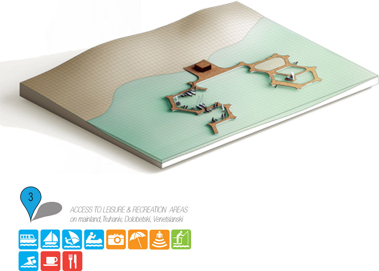
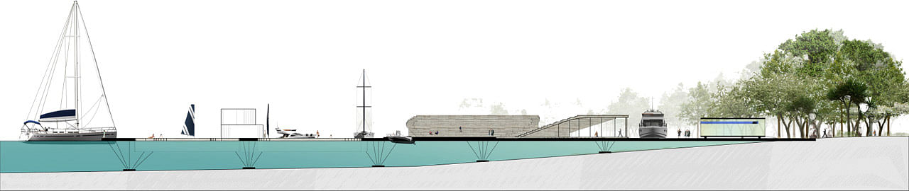
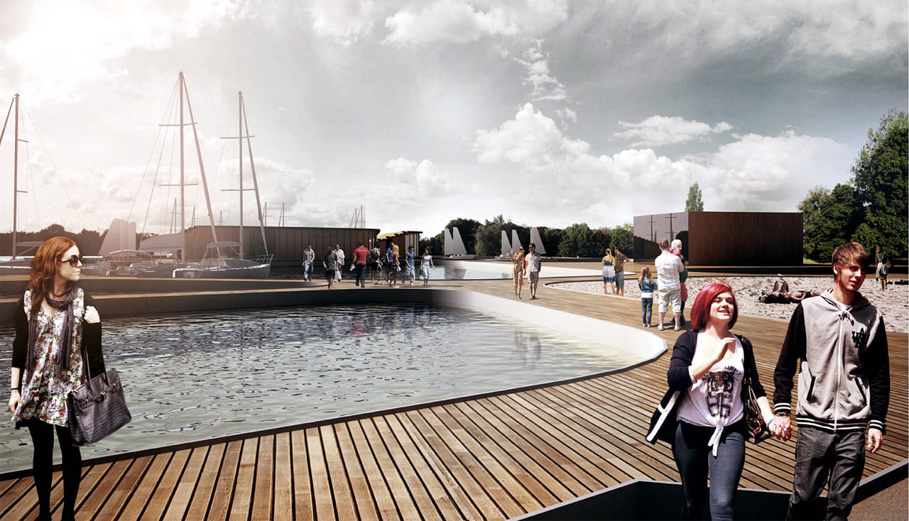
The main points for access on the islands are TBL stations, on the water. The flexible modular system allows for the stations to be easily built and with relatively low costs of fabrication. Also maintenance and rapid changing of station configuration is facile when necessary. The TBL stations are more than just stops on a route. They provide various services as well as info points about the city and Kiev Islands. Locals and tourists alike will have the chance to be better informed on the character, history and conservation status of every island. The module assemblage is defined by the main functional character for each island. Where the public access is limited the water stations meet limited functions such as mooring, ship boarding and disembarkation. For the islands where urban development is encouraged the water stations become more complex and the module assemblage generates mixed-use areas with cultural and leisure characters.
TBL’s feasibility is easy to predict as it ensures mass transportation with little building costs and requires no infrastructural development on the islands. This new transport system will become the main north-south transit system of the city as it will connect both Dnieper’s banks and the city’s landmarks. Building it is very cost effective since there are no tunnels or land expropriations to be done. Also implementing THE BLUE LINE can be achieved in a much shorter period than other time effective transit systems such as a metro line. Kiev will enrich itself and greet tourists with a scenic and iconic public transportation route which can be used as a city branding strategy similar to major cities around the world such as London’s Double decker Bus or San Francisco’s Cable Car.
Because of its mass appeal for the tourists and locals, the water transit system is not only an efficient public transportation system, but also a great city branding and communication platform. Thus Kiev city has the chance to present itself in its true colors and promote the image of a “green-blue” metropolis for the future. THE BLUE LINE project can function as a catalyst for the modernization of Kiev.
Project Details:
Project: Kiev Islands Master Plan
Year: 2012
Client: Kiev City State Administration
Location: Kiev, Ukraine
Program: Urban Planning
Area: 1,840 ha
Status: Competition, Winner
Team Wolf House Productions (Iulian Canov, Cristina Zlota, Vlad Stoica, Alexandru Tudose, Rozina Dragomir),
Gabriel Pascariu
Find more plans and diagrams in the image gallery below.


Share
0 Comments
Comment as :